

Project Overview
RAAN is a smart farming application built for sugarcane farmers in Maharashtra. It brings soil health, satellite crop monitoring and AI-powered advice together in one easy-to-use mobile app, available in Marathi, Hindi and English.
Farmers draw their field on a map once, and RAAN turns soil data, satellite imagery and weather into clear, field-level recommendations: what the soil needs, which part of the field is under stress, and what action to take next. The platform also supports sugar mills, which need an aggregated view across the fields of all their registered farmers.
Raaya Consultancy and Services designed and developed the Flutter mobile app and its AWS cloud backend, including the soil analysis engine, satellite vegetation-index pipeline and AI advisory integration.
View app on


App Interface
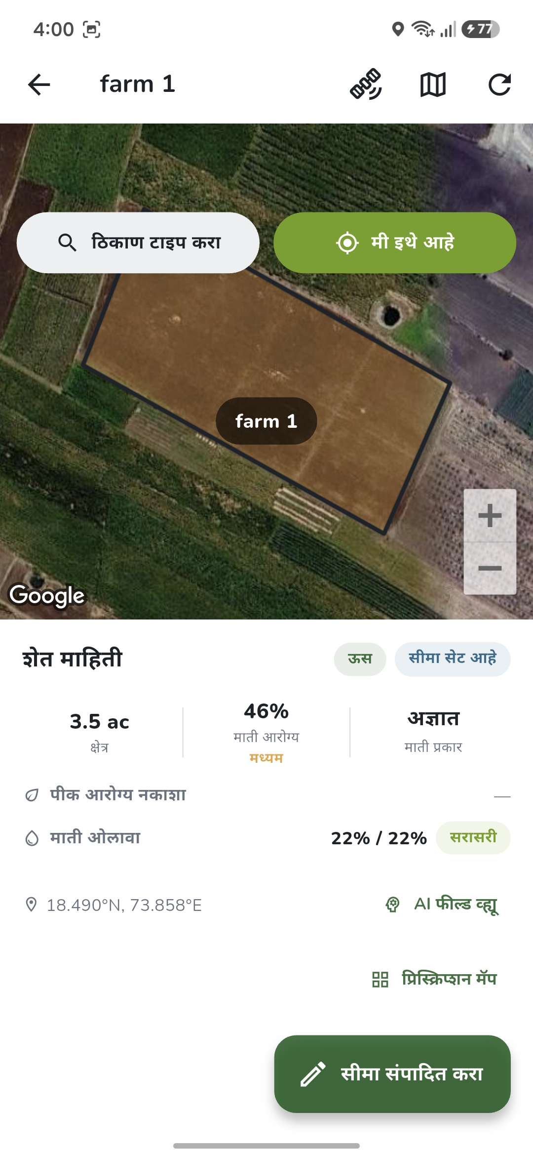

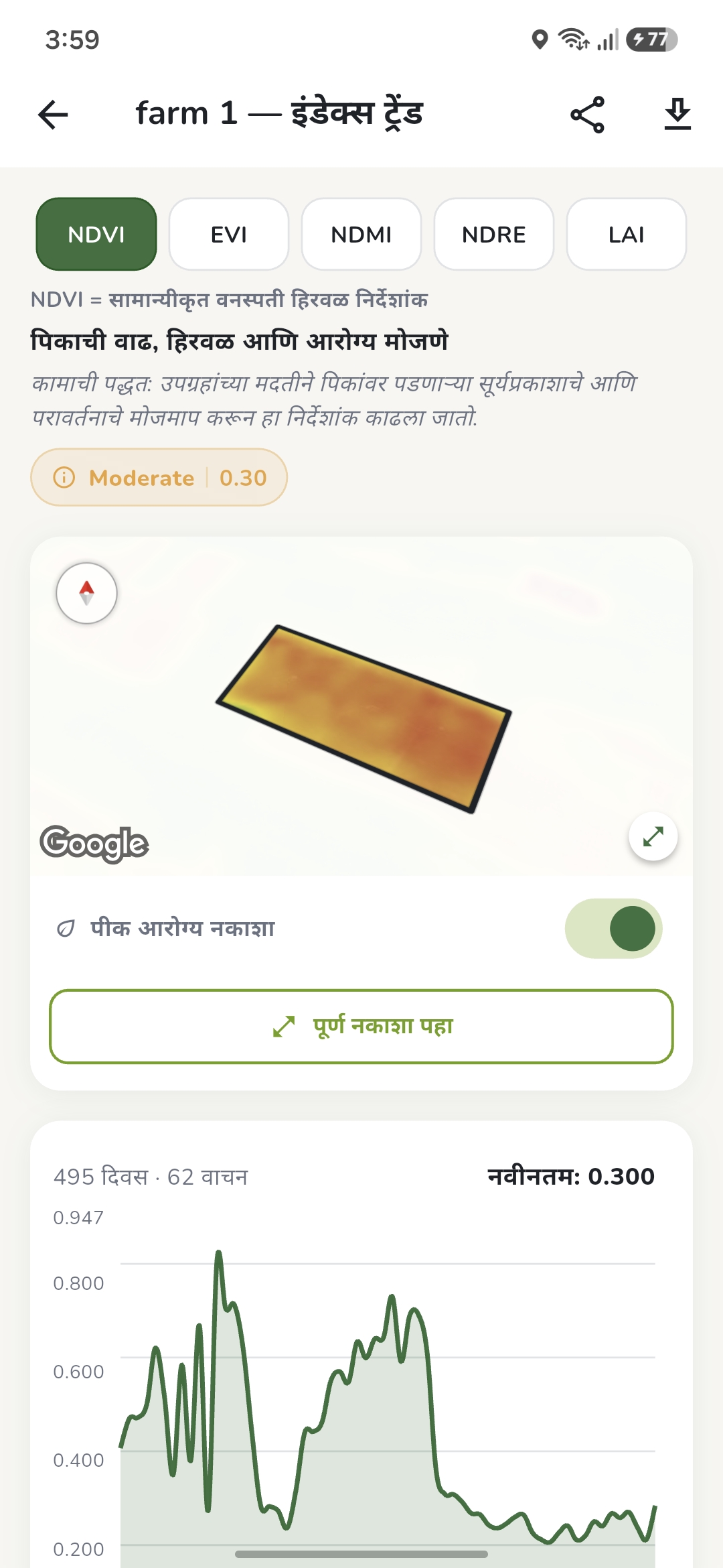
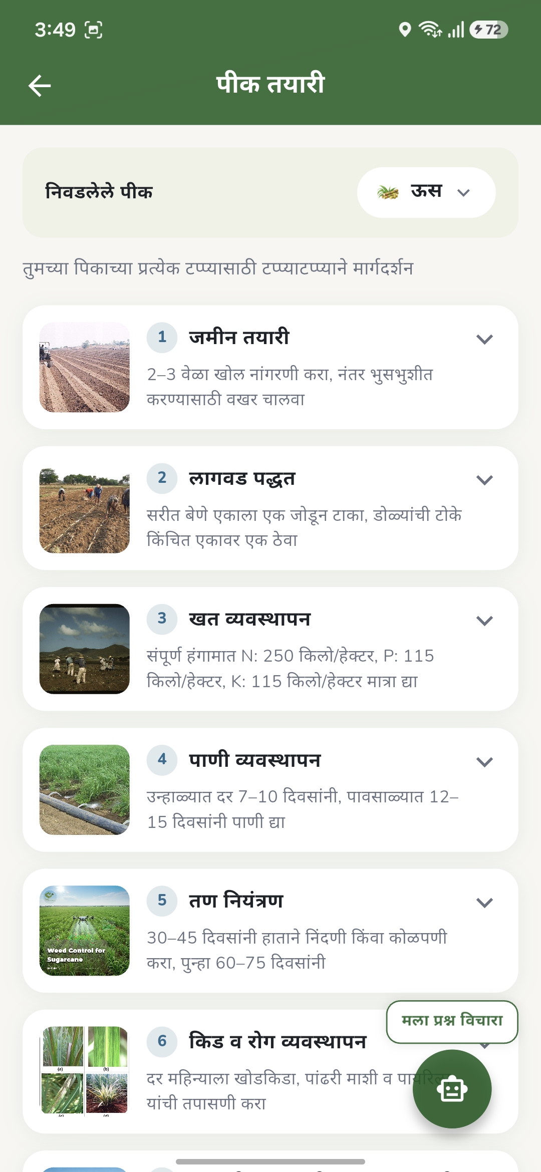
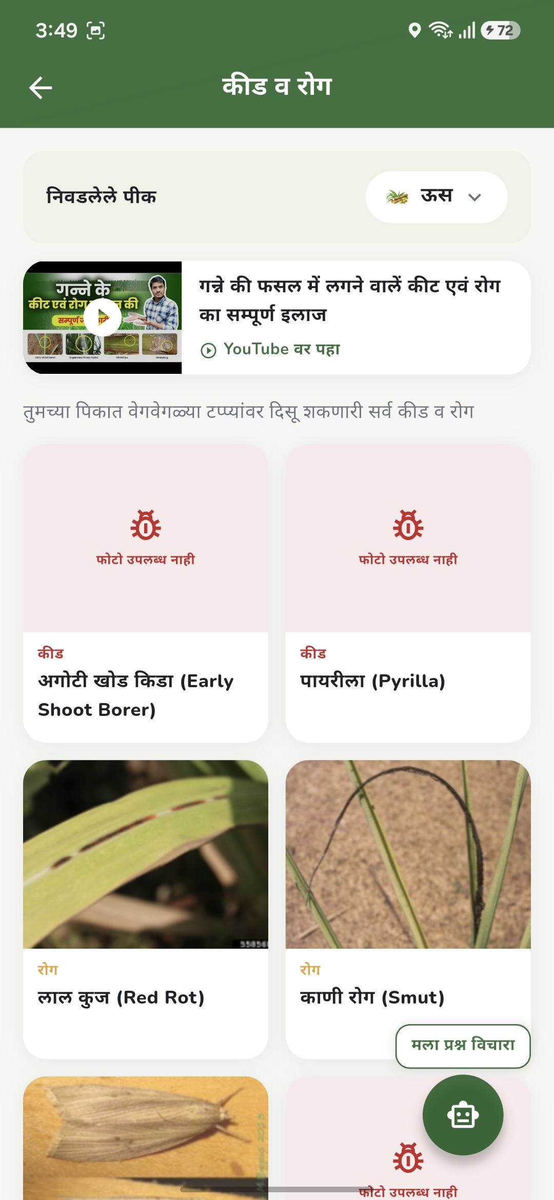
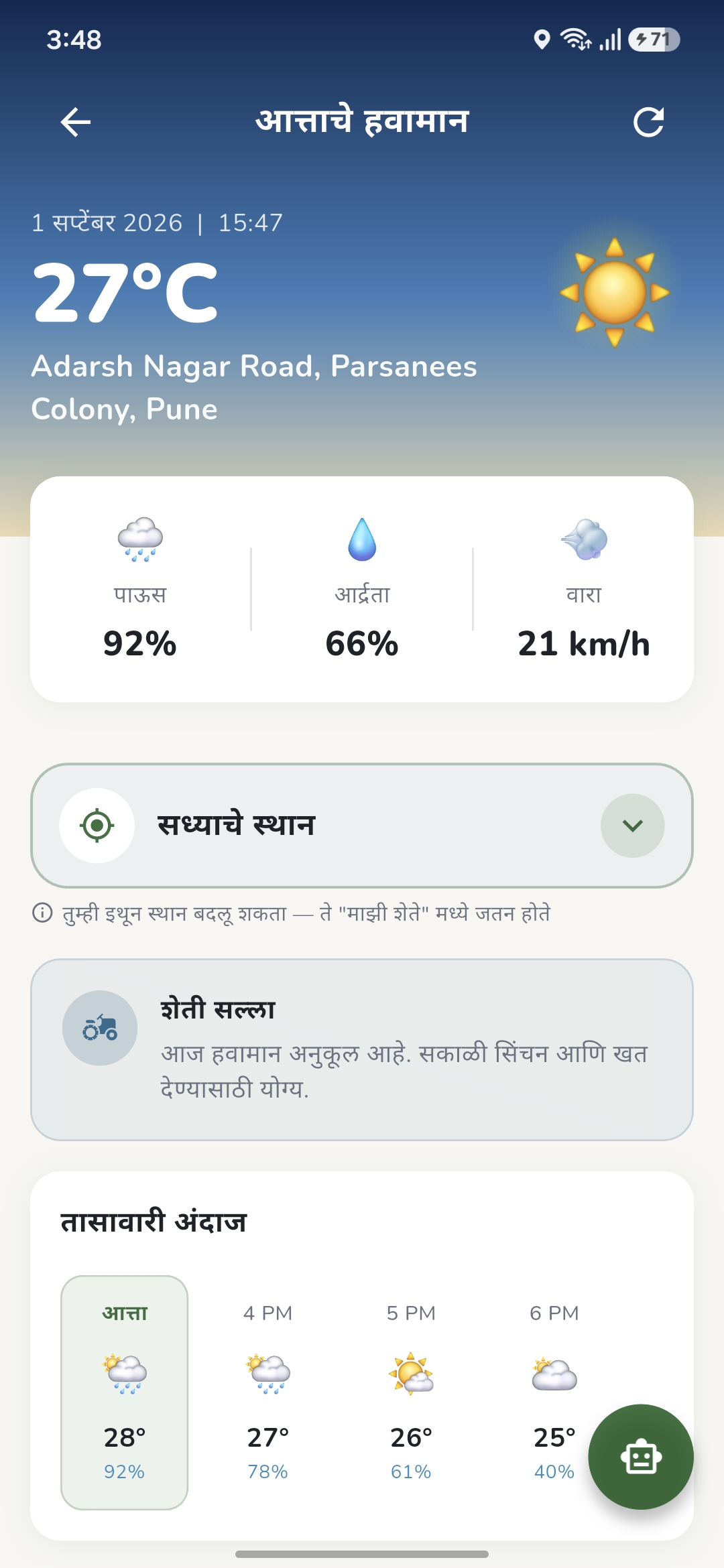
Key Features
- Soil Intelligence
- Field-level soil parameters such as pH, organic carbon, nitrogen, CEC, texture and bulk density
- Clear status labels (low / ideal / high) that a farmer can understand at a glance
- Downloadable soil reports and fertilizer planning guidance
- Satellite Crop Monitoring
- Sentinel-2 satellite imagery for every registered field
- Seven vegetation indices including NDVI, EVI, NDMI, NDRE and MSAVI to track crop health, moisture and nutrient stress
- Field divided into zones so farmers see exactly which part needs attention
- History mode to compare crop health across dates
- AI Advisory & Crop Scan
- AI combines soil, satellite and weather data into simple, practical recommendations
- Farmers can photograph a crop to check for pests and diseases
- Field Mapping
- Farmers draw their field boundary directly on the map
- Map shows vegetation in green and bare soil in soil colour, making boundaries easy to trace
- Farmer & Mill Views
- Farmers monitor and manage their own fields
- Sugar mills get an aggregated view across all registered farmers’ fields
- Multilingual & Farmer-Friendly
- Full Marathi, Hindi and English support
- Simple OTP-based mobile login, no passwords to remember
- Farmer education content alongside advisory
Challenges
- Making Complex Data Understandable
Challenge: Soil chemistry and satellite indices are technical, while RAAN’s users are farmers who prefer their own language and simple guidance.
Solution: All data is translated into plain status labels, colour-coded maps and short action-based recommendations, delivered in Marathi, Hindi or English. - Cloud Cover in Satellite Imagery
Challenge: During the monsoon, clouds hide fields in satellite images and can produce misleading crop-health readings.
Solution: Per-pixel cloud masking removes cloudy areas before analysis. The app clearly shows when imagery was last updated, the cloud coverage percentage and the next suitable observation, so farmers always know how fresh the data is. - Accurate Soil Data
Challenge: Global soil datasets use different units and scaling factors, and incorrect conversion can lead to wrong fertilizer advice.
Solution: A dedicated soil analysis module handles all unit conversions, and only parameters with genuinely reliable data are shown to farmers. - Zone-Level Analysis at Scale
Challenge: Splitting every field into zones multiplies satellite processing requests and cost, and data providers enforce rate limits.
Solution: Field boundaries are clipped into a zone grid on the server, results are cached, and processing is tuned to stay within provider limits while keeping costs predictable. - Reliable OTP Login in India
Challenge: SMS OTP delivery in India must follow DLT regulations, and non-compliant messages are silently blocked.
Solution: The OTP flow was diagnosed and configured for DLT compliance, giving farmers a dependable mobile-number login.
Development Process
Research & Planning
- Studied existing agri-advisory apps and found none offered field-level soil analysis with downloadable reports
- Evaluated soil and satellite data sources for accuracy, licensing and cost
- Designed the app screens in Figma with a farmer-first, regional-language approach
Mobile App Development
- Built the app in Flutter
- Integrated Google Maps for navigation and field drawing, with satellite and crop-health map modes
- Implemented multilingual UI with correct Devanagari rendering
Cloud Backend
- Serverless backend on AWS (Mumbai region): Lambda, API Gateway, DynamoDB, S3 and Cognito OTP authentication
- Soil data pipeline using SoilGrids with a fetch-once-and-cache design
- Vegetation-index engine using Sentinel Hub with cloud masking and zone-level results
- AI advisory layer using Google Gemini to turn combined data into recommendations
Testing and Optimization
- Cross-checked app soil results against laboratory soil test reports for real farm plots
- Optimized satellite processing and server timeouts to reduce cost and response time
- Verified Marathi and Hindi text rendering across screens and reports
- Simplified screens and tabs based on how farmers actually use the app
Outcome
- Field-Level Insight for Every Farmer: Farmers get soil and crop-health information for their own field, not generic district-level advice.
- Early Problem Detection: Zone-wise satellite monitoring highlights stressed areas of a field before problems spread.
- Smarter Fertilizer Use: Soil-based guidance helps farmers apply the right inputs where they are actually needed.
- Accessible in the Farmer’s Language: Marathi, Hindi and English support makes advanced agri-technology usable by rural farmers.
- Scalable for Mills: The cloud architecture supports both individual farmers and sugar mills managing many fields.
Tech Stack: Flutter · AWS (Lambda, API Gateway, DynamoDB, S3, Cognito) · Sentinel Hub · SoilGrids · Google Gemini · Google Maps